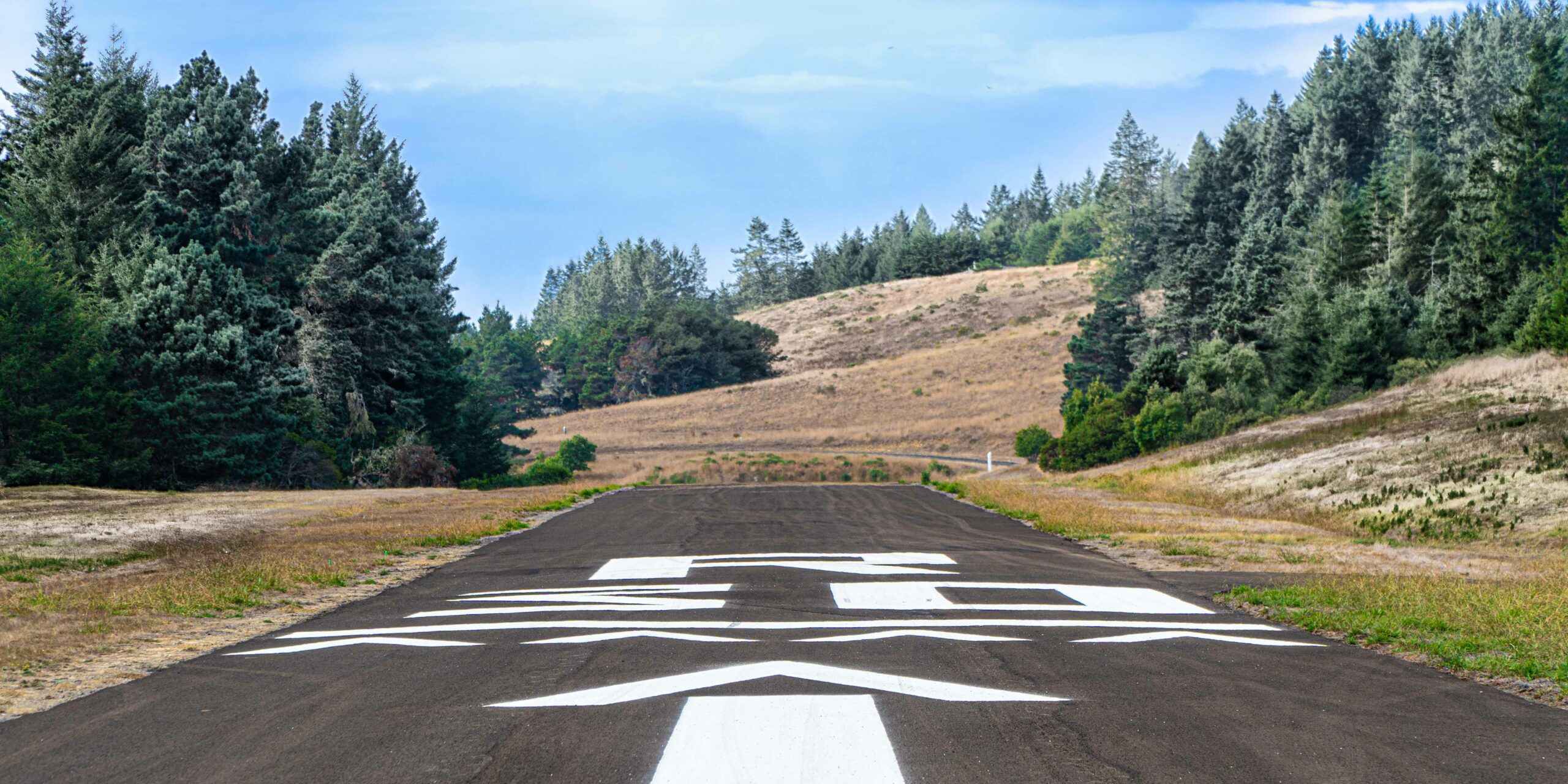
Photo by Bill Oxford.
A private airstrip, FAA ID CA51, is available for The Sea Ranch Association members, guests, and renters. Landings and takeoffs occur during daylight hours, and touch and go landings are prohibited. Tie-downs are available, but no other services. The hangars are privately owned. Aircraft and parked vehicles are required to display a valid Sea Ranch ID or hang tag. Note that ground transportation services such as taxis or private drivers (available through smartphone applications) are very limited in this coastal area and may not be available. Download printable briefing document
(CA51) N38˚42.2 W123˚25.8
RWY 12-30 H2600X40 (ASPH), unlighted.
CAUTION:
- RWY 12-30 has a hump midfield preventing full view of the entire runway length when on the ground.
- Turkeys and deer are frequently on or near runways.
- During high wind and gusty conditions pilots can expect turbulence, and possible wind shear with associated loss of
lift. - The displaced threshold markings for RWY 30 are incorrect; the runway is not greater than 100’ wide but 40’ wide.
Airport Remarks:
- No operations from sunset to sunrise. No touch & go operations. VFR only.
- Aircraft having a published accelerate-stop distance performance chart are prohibited from takeoff if the calculated
distance for current conditions and aircraft loading exceeds 2300’. - No fueling services.
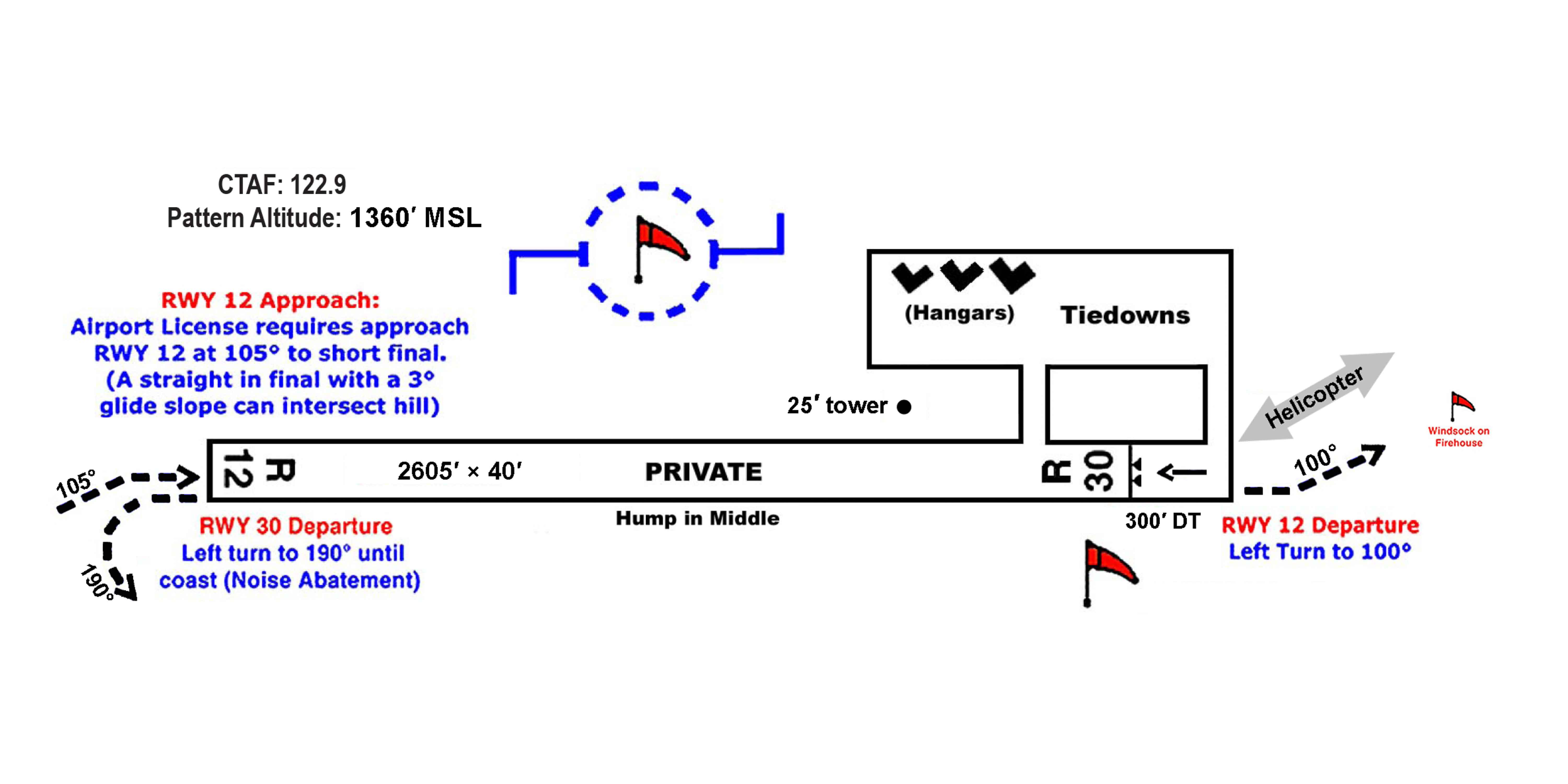
- Field elevation 360’ MSL, Traffic Pattern Altitude 1360’ MSL (1000’ AGL).
- CTAF 122.9, non-certified AWOS 122.9 (5 clicks) or phone (707-600-3847).
- A 25’ weather tower is near the airport windsock.
- The area is noise sensitive. Pilots are asked to select airspeeds, power settings and bank angles as much as safely possible to mitigate noise.
RWY 12 approach: Airplane
- Enter traffic pattern from a 45˚ to right downwind.
- Turn final early from the base leg to 105˚ due to terrain encroaching on the 3˚ approach angle.
RWY 30 approach: Airplane
- Enter traffic pattern from a 45˚ to right downwind.
- Note RWY 30 has a 300’ displaced threshold.
RWY 12 departure: Airplane
- After takeoff, when able turn left to 100˚.
RWY 30 departure: Airplane
- After takeoff, when able turn left to 190˚ to the coastline, then proceed on course.
- Note RWY 30 has a 300’ displaced threshold.
Helicopter Operations
- When conditions allow, helicopter pilots are requested to use RWY 30 for landing and RWY 12 for departure with Annapolis Rd to the Southeast of the airstrip as a preferred route. This routing minimizes the noise impact on the local community.
- When the pilot deems it unsafe to use RWY 30 landing/RWY 12 departure, the airplane procedures for RWY 30 departure and RWY 12 approach should be followed.
- Except for emergency helicopter operations, ground run times shall be kept to less than 5 minutes.
