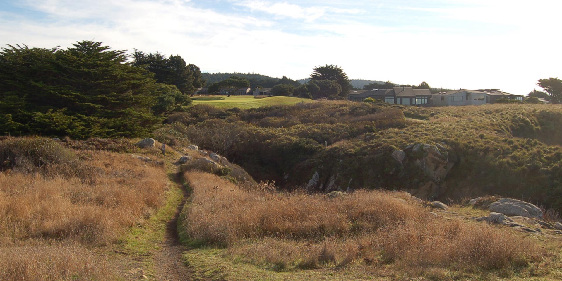
Bluff Trail at Salal Creek. Photo by Nelson Scott Smith.
Over 50 miles of trails at The Sea Ranch are open to hikers. Many of these trails can also be enjoyed by bikers and equestrians; exclusions are noted on the Trails Map. Numbered Trail Posts [TPs] point hikers and riders in the right direction, and rest/view logs and occasional benches provide opportunities to rest and enjoy forest scenery and ocean vistas. Rules are few: bikers yield to hikers and equestrians; hikers yield to equestrians; dogs must be leashed; whatever you bring onto the trails, you must bring out – this includes dog waste bags. Smoking is not permitted anywhere on Sea Ranch Commons.
You may purchase a map at the Association Office, during office hours (Tuesday – Saturday, 8:30 am to 5:00 pm) for $10.00.
Interpretive (Self-Guided) Trails
There are six self-guided Interpretive Trails at The Sea Ranch. All are highlighted in yellow on the Trails Map; guide brochures describing historic and natural features are located on or near the trails, and can be downloaded by clicking on the underlined titles below. Many of the brochures are available in wooden boxes at each trail — pick up a brochure to read on the trail, then return it at the end of your walk if you don’t think you will need it again. Some of the brochures can also be accessed via QR codes.
The Audio Walking Tour: Architecture, Landscape, Intentions introduces the architecture and landscape of The Sea Ranch, noting the ideas and features that have made it world renowned. Written and narrated by Donlyn Lyndon, one of the original Sea Ranch architects, this self-guided audio guide explains what was intended in planning The Sea Ranch and in creating the early buildings. Lyndon comments, as well, on the evolution of the landscape during the subsequent fifty years. Major stops in the southern half of The Sea Ranch are discussed in detail. These include Moonraker Recreation Center, Brigantine Reach, the Sea Ranch Lodge, Condominium One, and Bihler Point.
The Reading Our Seascape Guide describes sights along a section of the Bluff Trail from approximately TP 6 (just west of Galleon’s Reach) to TP 10 at Navigator’s Reach. The guide brochure describes many of the marine mammals and birds that may be seen along the shore, as well as various geographical features. It describes the ecology of the coastal upwelling zone along our shore, and the California Coastal National Monument, which includes all the islands offshore of California. This guide is currently available only at the Association office or by download.
The Del Mar Landing Marine Reserve runs between TP 54 (Solstice) and TP 64 (Fish Rock). This Marine Protected Area protects fragile habitats by prohibiting fishing, harvesting, or injury to any living marine organism within its boundaries. A walk through this reserve allows you to experience four distinct habitats which are home to thousands of species of invertebrates, algae, fish, marine mammals, and seabirds. You can access the guide brochure for this area by using your smartphone to photograph the QR code at either of the trail boxes near TP 54 and TP 64, then explore the geology, plant, and animal life typical to the area as you proceed along the trail posts.
The Monarch Glen Interpretive Trail is on the west side of Highway 1 just north of mile marker 56.06. Its trailhead is best reached by walking along the cypress hedgerow northeast from One-Eyed Jack’s to TP 36D. The guide brochure is available at a trails box at that trail post or by using your smartphone to photograph the QR code posted there. The guide brochure describes trees, shrubs, and other plants along both branches of Monarch Creek, as well as birds and other wildlife. Several unusual examples of redwood growth are also featured, as well as old Ohlson ranch sheep sorting pens. And there is a long, 18″ deep trace of original ranch road, which leads to one of the old red gates.
The Sag Pond Story Interpretive Guide describes habitat, plants and animals that might be found in the unique aquatic habitat of our eight sag ponds, and explains the geologic processes that create the sag ponds. The guide includes discussions of symbiotic relationships among plants that are found only in one place on The Sea Ranch — in these sag ponds. Five of the ponds are accessed by spur trails from other trails and from roads, and feature the distinctive sag pond marker posts. This guide brochure is available at the Association office, by download, and by using a smartphone to photograph a QR code on a sag pond marker post.
The San Andreas Fault Interpretive Trail (SAFIT) is just above the Hot Spot on River Beach Road. It features 4 ridges with associated swales and hummocks (created by parallel faults), a sag pond, and broken trees and displaced/recaptured drainage channels from 1906 and earlier earthquakes. The trail also features historical remnants from 1890’s logging of original ancient redwoods (such as springboard notches and skid trails), forest ecology of unique overstory, understory and ground cover, as well as stump islands colonized by redwood sorrel (oxalis). The SAFIT Guide brochure can be picked up at wooden boxes at either end of the trail (TP 305 and TP 307) and can be downloaded to smart phones via QR codes posted on these boxes.
Park at the small parking area just west of TP 305, or down at the Hot Spot or up on Deep Woods Drive and walk up (or down) River Beach Road to the trailhead at TP 305. Sea Ranchers who want to drive down River Beach Road when it is closed to vehicles (generally after Labor Day to Memorial Day) can obtain the code to the lock by signing a Hot Spot Vehicle Access Form. This form can be accessed at https://www.tsra.org/hot-spot-winter-vehicle-access/.
Historic Markers
In recognition of the complex and varied history of the Sea Ranch, the Archives Committee has placed informative markers on TSR trails. These historic markers document the history and identify many of the significant sites on The Sea Ranch. They are noted on the Trails Map by a small tan square. In addition to the sign, a text-based QR code provides an expanded description that you can read with a Smartphone. A fascinating and more complete description of each of the 25 historic sites, and the events and people they evoke, can be found in the brochure, available by download (Preserving Sea Ranch History: A Historical Journey on our Trails, May 2014 by Harry Lindstrom), and by purchase at the Association office.
Architecture/Landscape Markers
The 25 historic markers (noted above) have been followed by 20 Architectural/Landscape Markers, which signify significant elements and characteristics that have evolved since The Sea Ranch was conceived in 1963, and the intentions that have guided the development of this place for more than 50 years. These markers are noted on the Trails Map by a small box enclosing a black dot. These markers may also be located by using Donlyn Lyndon’s Place at The Sea Ranch: Architecture/Landscape Markers on Our Trails. It can be downloaded here, and also purchased at the TSRA office, at The Sea Ranch Lodge, and at Four-Eyed Frogs Books in Gualala.
Accessibility
Barrier Free Trail
Access the Barrier Free Trail from Piper’s Reach at either TP 35A or TP 36A. Vehicle parking is available at both access points. The BFT provides a specially hardened and graded surface on a section of the Bluff Trail designed for wheeled mobility devices. Viewing areas at the north end of the BFT look over the bluff to a seal rookery.
Bicycle-Pedestrian Links
Because there are no paved roads – other than Highway One – that run all the way from one end of The Sea Ranch to the other, five bicycle-pedestrian links of varying lengths have been established with hardened surfaces to enable bikers on both mountain and street bikes to traverse the entire Sea Ranch without venturing onto the highway. These run from Trail Post 3D to TP 3E (.26 miles), from TP 9A to TP 9B (.09 miles), from TP 10A to TP 13B, from TP 14C to TP 15B (.26 miles), and from TP 18 to TP 25C (.20 miles). Other Sea Ranch Trails where bicycles are permitted are highlighted on the most recent Trails Map.
Easy Access Trails
Easy access trails are designed for people with limited mobility and for strollers. There are six easy access trails that lead to the Bluff Trail at TPs 3, 6, 10, 24, 43, and 71. Each EAT leads from an area with parking to the Bluff Trail, then along the Bluff Trail to a rest/view log. Short horizontal bars on the Trails Map indicate these trails.
Accessibility Guide – Bluff Trail
The Trails Committee has published an Accessibility Guide to the Bluff Trail, with detailed descriptions of all segments of the trail and estimates of accessibility to people using manual wheelchairs, powered wheelchairs, or mobility scooters, or who have other mobility issues. The guide can be downloaded here.
Trails Mileage Spreadsheet
The Trails Committee has developed an Excel spreadsheet of walking distances between trail posts on TSR trails, along with total mileages for individual trails, the Circumambulation, and most trails in Gualala Point Regional Park. Biking distances for the length of TSR using roads and the bicycle-pedestrian connectors are also included. Mileages were calculated by GPS and other methods and can be found here. This spreadsheet was compiled in 2018 and has not been updated. Some anomalies complicate its use. Three trails added since 2018: Sea Forest Trail, Del Mar Loop Trail, and Tallgrass Leeward Road Connector. Minor changes to routes of the Chapel Trail and the Ridge Trail have been created, and a few trails and segments of trails have been renamed.